
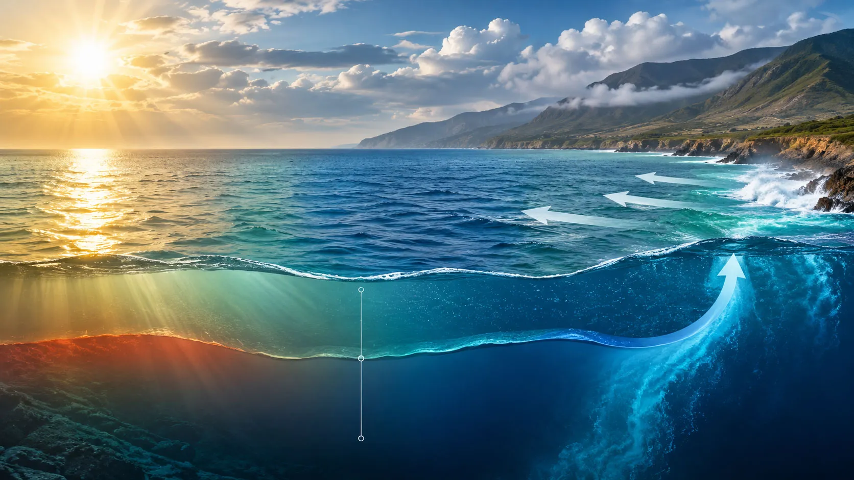
Several interacting factors determine how warm or cold seawater becomes, with sunlight providing the main source of heat at the ocean surface. Latitude, season, cloud cover, winds, ocean currents, water depth, and the exchange of heat between the ocean and atmosphere all influence the temperature measured at a particular location. This is why two coastal areas at similar latitudes can have noticeably different sea temperatures.
Temperature also changes vertically through the ocean. Sun-warmed surface water generally overlies colder deep water, while mixing, currents, and upwelling can move heat in different directions. Salinity matters as well because temperature and salt content affect seawater density, helping drive large-scale circulation that redistributes heat around the planet.
Sunlight Is The Primary Source Of Ocean Heat
The ocean absorbs solar radiation, and the amount of solar energy reaching the water varies mainly with latitude, season, time of day, and atmospheric conditions. Areas near the equator generally receive more direct sunlight throughout the year than areas near the poles, so their surface waters tend to be warmer.
Seasonal changes alter the amount of solar energy received at a given latitude. During summer, longer days and a higher Sun angle generally increase the energy available to warm surface waters. During winter, reduced solar input and greater heat loss to the atmosphere can cool them.
Clouds and atmospheric conditions also affect how much solar radiation reaches the ocean. The result is a constantly changing balance between energy entering the sea and heat leaving it.
Latitude And Season Create Broad Temperature Patterns
Latitude provides one of the clearest large-scale controls on sea surface temperature. Tropical waters are generally warmer because sunlight arrives more directly, while polar waters receive less concentrated solar energy.
However, latitude alone does not determine the temperature at a particular coastline. Ocean circulation can transport warm or cold water far from where it was originally heated or cooled. NOAA notes that ocean currents redistribute warm water from lower latitudes and cold water from higher latitudes, influencing regional climate as well as seawater temperatures.
| Factor | How It Affects Sea Temperature |
|---|---|
| Solar radiation | Provides most of the heat entering the ocean and varies with latitude, season, time of day, and atmospheric conditions. |
| Ocean currents | Transport warm or cold water between regions and can substantially alter local temperatures. |
| Wind | Promotes surface mixing and can move surface water or contribute to upwelling. |
| Depth | Temperature usually decreases below the warm surface layer, with a strong gradient often occurring through the thermocline. |
| Salinity | Changes seawater density and therefore contributes to circulation that redistributes heat. |
| Atmosphere | Exchanges heat with the ocean through processes such as evaporation and heat loss or gain at the surface. |
Ocean Currents Move Heat From One Region To Another
Ocean currents are an important reason sea temperature does not simply follow latitude. Surface currents are strongly influenced by winds, while deeper circulation is also affected by differences in water density caused by temperature and salinity.
A warm current can carry tropical water toward higher latitudes, while a cold current can transport cooler water toward lower latitudes. Coastal regions may therefore have seawater temperatures that differ substantially from those expected from latitude alone.
Winds can also drive coastal upwelling. When deeper, colder water rises toward the surface, the sea surface temperature in that area can become considerably lower than in nearby waters. Upwelling can simultaneously bring nutrients from deeper water into the sunlit surface layer, making these regions important marine ecosystems.
- Warm currents can raise temperatures along coastlines they reach.
- Cold currents can cool nearby surface waters.
- Upwelling can bring colder deep water toward the surface.
- Wind-driven mixing can redistribute heat through the upper ocean.
Why Does Sea Water Get Colder With Depth?
Sunlight heats the upper ocean much more effectively than the deep ocean. As depth increases, less solar energy is available to warm the water. Consequently, the ocean commonly has a warm upper layer above progressively colder water.
The transition between relatively warm surface water and colder deep water is known as the thermocline. Its depth is not fixed. Winds, currents, season, latitude, and ocean circulation can cause the boundary to become deeper or shallower.
Mixing can transfer heat downward, but it does not make the entire ocean the same temperature. NOAA explains that cold, salty water is denser than warmer water and can sink, contributing to deep-ocean circulation.
How Wind And Waves Change Surface Temperature
Wind does more than create waves. It can transfer momentum to the surface and promote mixing between layers of water. This can redistribute heat that would otherwise remain concentrated near the surface.
Strong or persistent winds can also contribute to coastal upwelling or downwelling, depending on their direction and the configuration of the coastline. The Coriolis effect, produced by Earth’s rotation, influences the direction in which moving ocean water is deflected and therefore affects large-scale circulation patterns.
How Salinity Influences Ocean Temperature Patterns
Salinity does not primarily heat or cool seawater. Its importance comes from its effect on density. Temperature and salinity together determine whether seawater tends to remain near the surface or sink.
When seawater becomes colder and, in some regions, saltier, its density increases. Dense water can sink and become part of deep-ocean circulation. This process, called thermohaline circulation, helps move water and heat over large distances.
Changes in evaporation, precipitation, river input, and sea-ice formation can alter salinity. In turn, these changes can influence the density structure and circulation of seawater.
Why Can Nearby Seas Have Different Temperatures?
Two places that are geographically close can still have different sea temperatures because their local conditions may not be the same. One location might receive a warm current while another is influenced by cold-water upwelling. Differences in depth, wind exposure, coastline shape, cloud cover, and freshwater input can also matter.
Shallow coastal water can respond relatively quickly to changes in atmospheric conditions because a smaller volume of water is being heated or cooled. Deep offshore water has much greater thermal inertia and is strongly influenced by mixing and circulation.
How Scientists Measure Sea Water Temperature
Scientists measure sea surface temperature using several complementary methods, including satellites, buoys, ships, ocean reference stations, and other observing systems. Satellite instruments can estimate sea surface temperature from infrared and microwave measurements, while in-water instruments provide direct measurements at particular depths and locations.
Measurements below the surface are particularly important because the temperature of the ocean cannot be understood from its surface alone. Profiling floats can record temperature, salinity, and pressure as they move through the water column, providing information about conditions thousands of meters below the surface.
What Determines Sea Water Temperature In A Particular Place?
At any specific location, sea temperature is the result of several processes acting together rather than one controlling factor. The most important considerations are the amount of solar energy received, the movement of water into and out of the area, exchange of heat with the atmosphere, and mixing between different layers.
This combination explains why seawater temperature can change over hours, seasons, or much longer periods. It also explains why temperature maps are useful for understanding weather, ocean circulation, marine ecosystems, and climate. NOAA identifies sea surface temperature as an important measurement for climate monitoring, weather prediction, and studies of marine ecosystems. …